FAA Resources

UAS Facility Map Decision Flow Chart

A facility map does not give you permission to fly a drone within controlled airspace.

You must submit an on-line request and receive FAA approval to fly in Class B, C, D, and Surface Area E airspace.

Below are some steps that may help reduce the time it takes the FAA to process your Airspace Authorization request.

1. Decide where you want to fly (such as the address and Latitude/Longitude.). 2. Open the map and type the address or Lat/Long where you want to operate in the SEARCH bar located at the top left corner of the screen. 3. Identify the altitude in the grid. This altitude is measured in feet above the ground level. If the proposed operation falls in multiple grids, identify the lowest altitude in all the grids in which you want to operate. 4. Find the Latitude Longitude (Lat Long) of the cursor on the lower left corner of the map. 5. Submit an airspace authorization request in compliance with the map altitude to operate in that specific location. 6. Authorization requests for an altitude in excess of the map altitude will require further coordination.

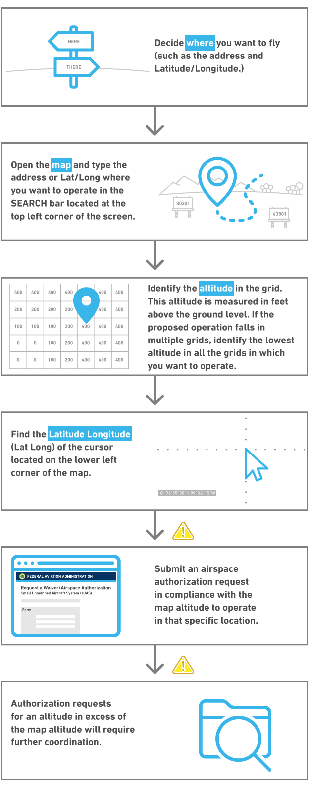
Original content for this page gathered from: https://www.faa.gov/uas/request_waiver/uas_facility_maps/flow_chart/